
History |
Erie by the Numbers |
Max. Depth210 feet
Elevation569 feet
|
Shore Length799 miles
Inhabited by Humans~3,000 years
Discovered by Europeans1669
|
Volume116 cubic miles
Surface Area9,910 square miles
|
Basin Map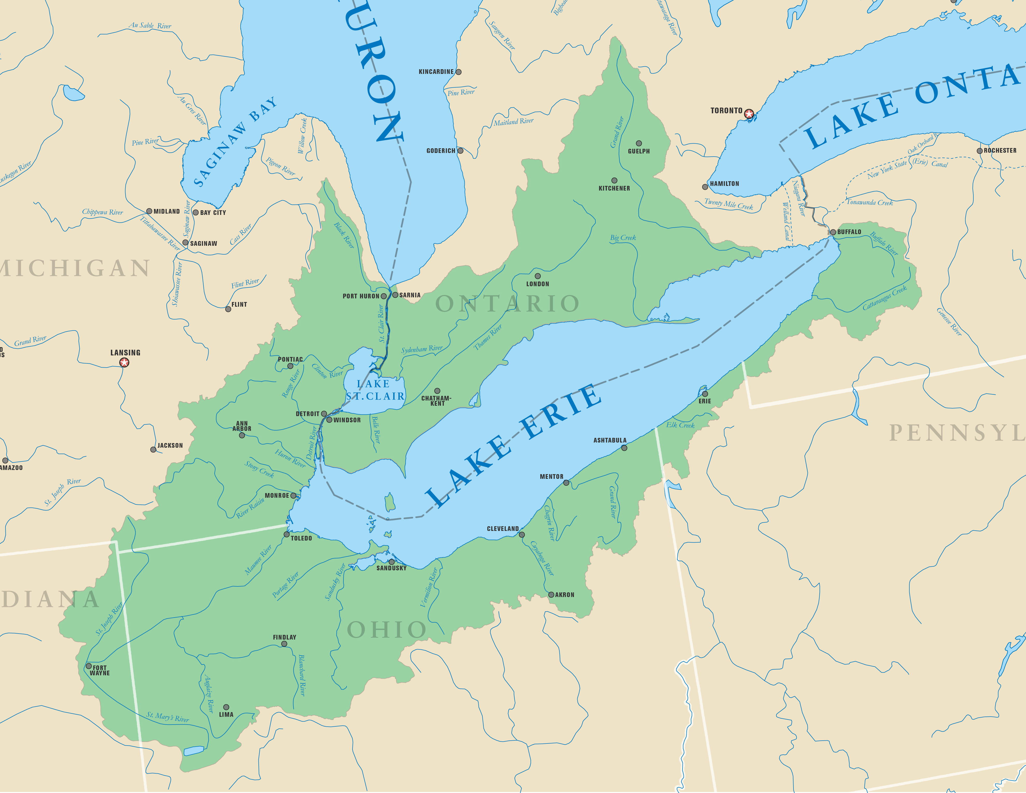
|
Bathymetric Map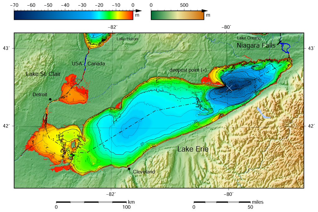
|
Major Cities
|
